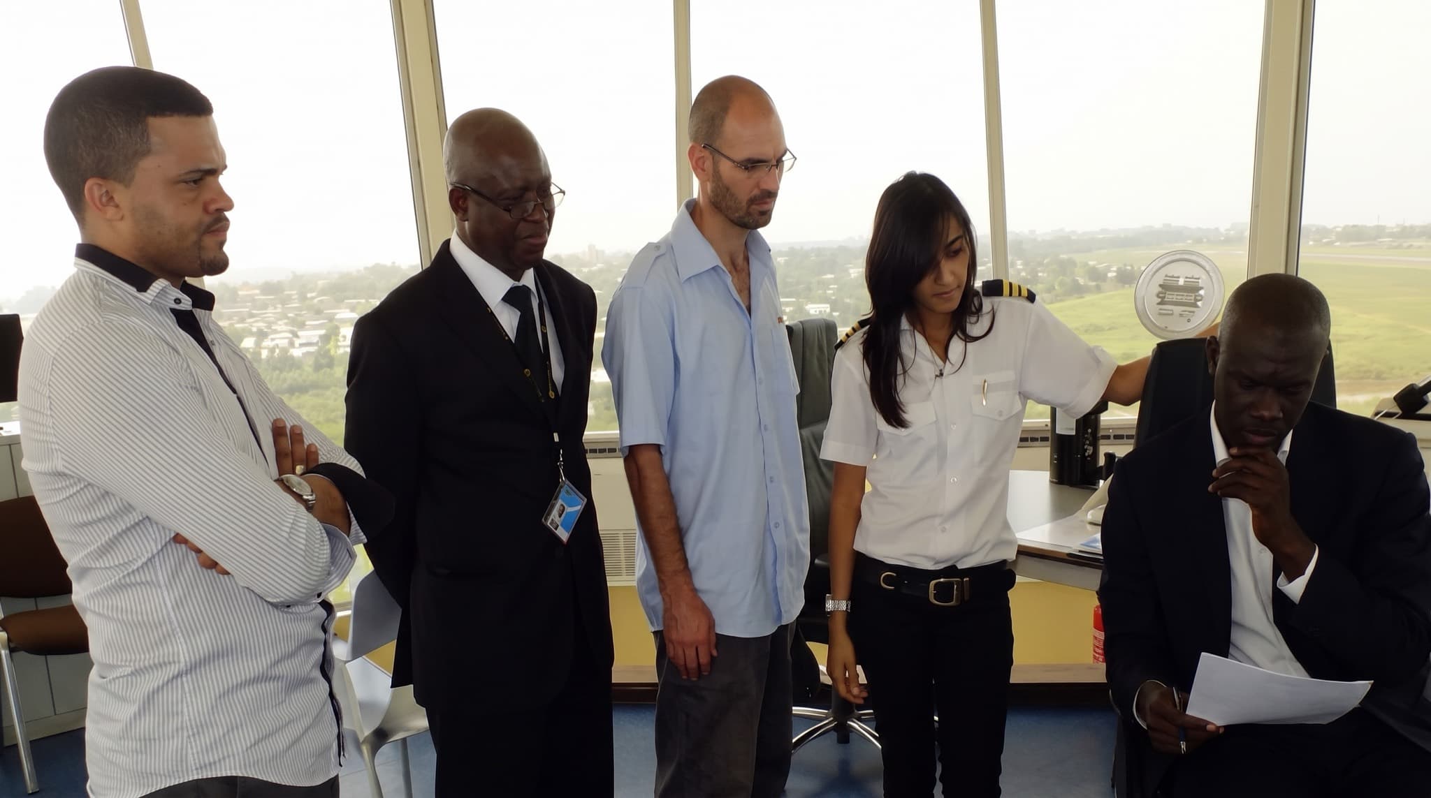
MDVIA aircrew during pre-flight planning, Libreville, Gabon

About MDVIA

8°50′S 13°14′E ●

Respect for the ground.
Command of the tools.

MDVIA's approach merges respect for traditional knowledge and disciplines with the most recent technologies. MDVIA Ltd. and MDVIA (Angola) Lda. develop innovative tools that span geo-information management, land and aerial surveys, mapping and engineering — brought together as a tailored solution for each client.

The discipline

The collection, analysis and presentation of geographical information have always been an important asset for nations and societies. Efficient management of geo-information plays a major role in the administration and control of land and property.

We believe only a combination of modern knowledge and respect for traditional disciplines can succeed in geo-information. Our approach stems from geodesy, mapping, geography and geology — which, together with extensive survey and reconnaissance experience, gives us a solid basis to tailor the right solution for every client.

40,000+ km²
Orthophoto produced
6–50 cm/px
Ground sample distance
±3 mm/km
Precision leveling
4 continents
Field operations

Archive

Frames from three decades of operations, pulled from the field log.

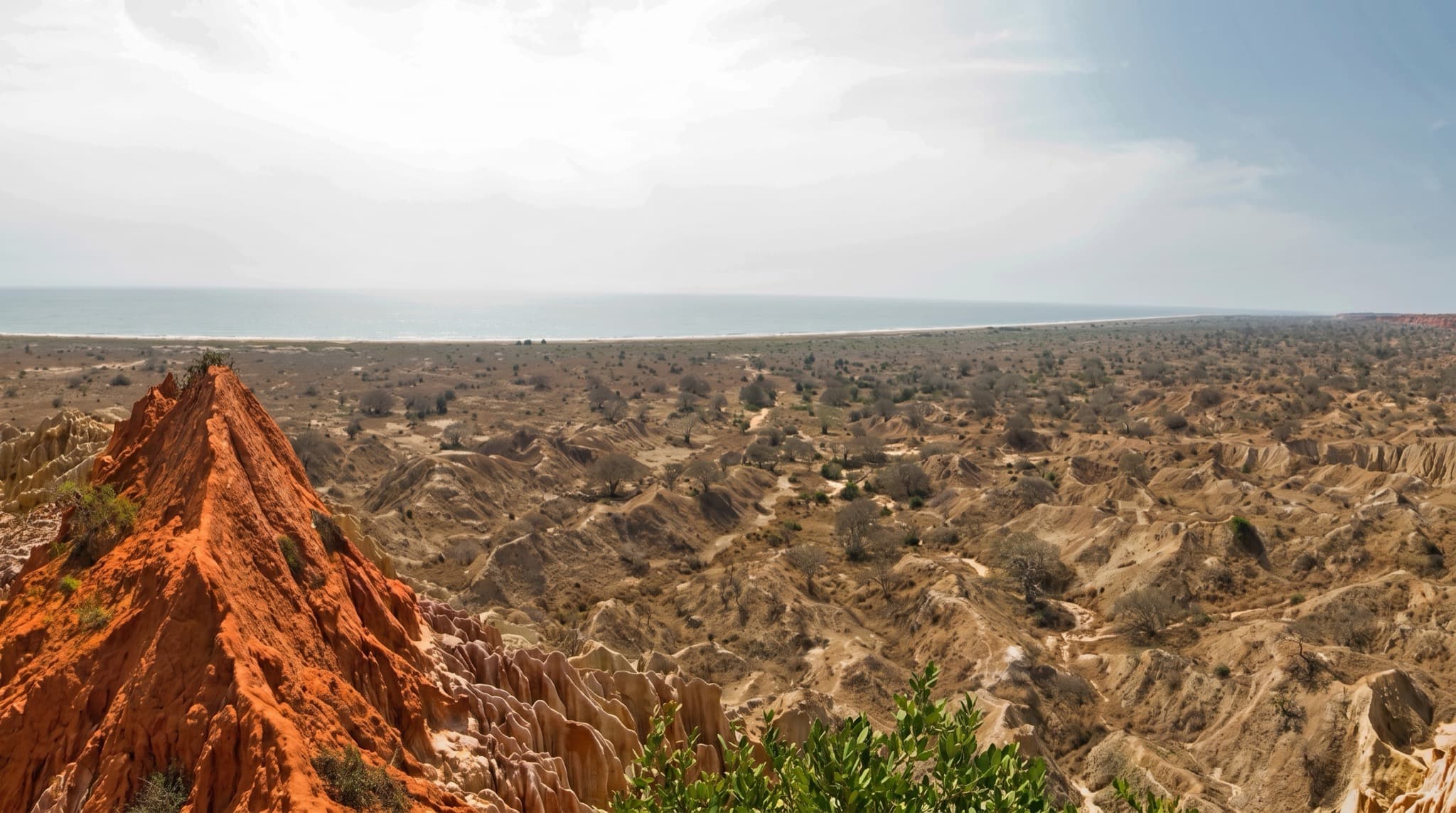
FRAME 05/10 — 9°06′S 13°04′E●
Panoramic view of Mirador de la Luna, south of Luanda, Angola
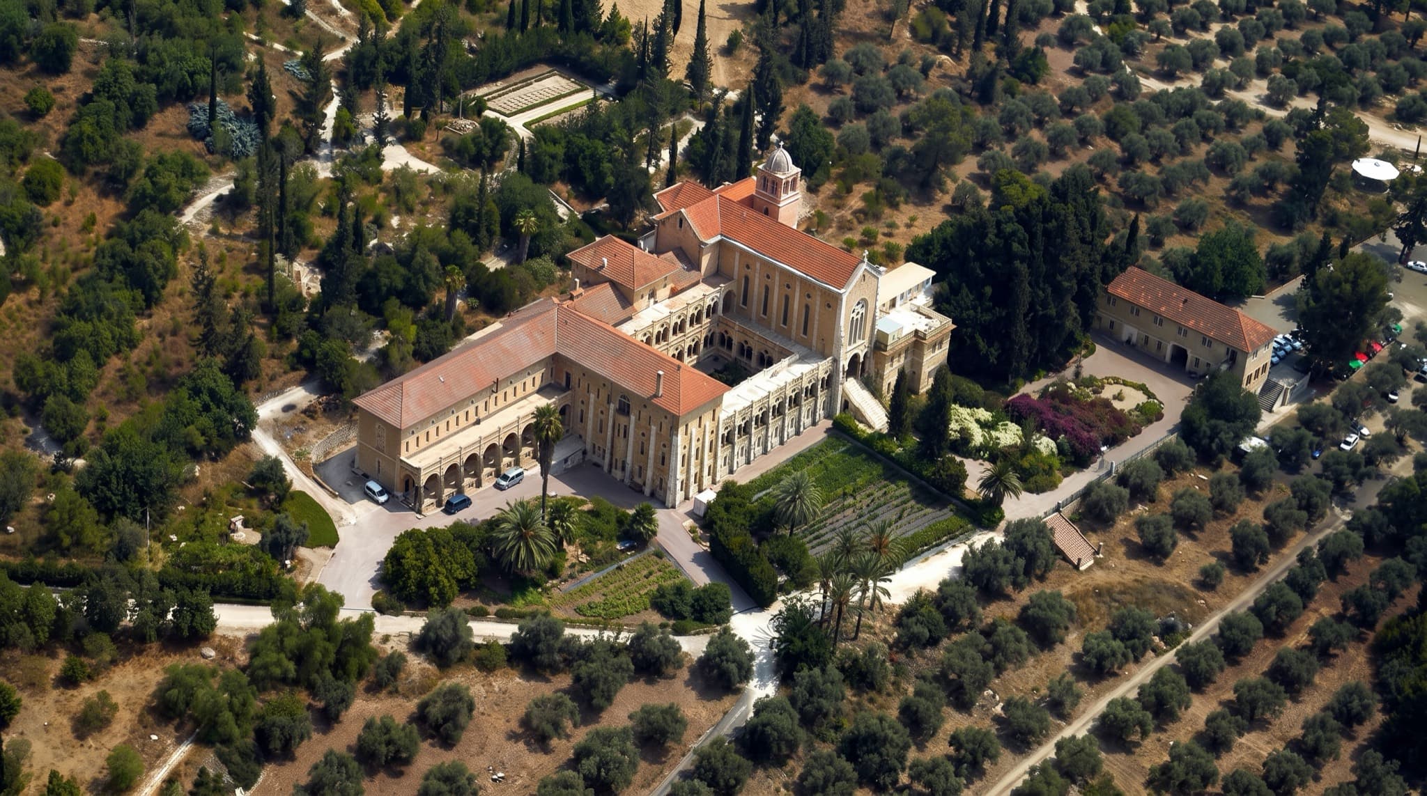
FRAME 02/10 — 31°50′N 34°58′E●
Oblique photography of the Latrun monastery, Israel
FRAME 09/10 — 17°23′S 66°10′W●
Vehicle extraction during road construction, 1975, Bolivia

Track record

Delivered work, condensed to one line each.

01Geodesy & GIS for 2D/3D seismic acquisitionCabinda, Angola
02Orthophoto production, 30,000 km²Kwanza Basin, Angola
03GIS center for a 27,000 km² seismic projectKwanza Basin, Angola
04Orthophoto production, 8,500 km²Namibe, Angola
05GIS center for seismic operationsNamibe Basin, Angola
06Orthophoto for upstream oil & gasD.R. Congo
07Orthophoto for irrigation planningNigeria
08Orthophoto at 8 cm GSDGabon
09GIS center for concessionsZaire Basin, Angola
10Reconnaissance mapping & ERW risk assessmentZaire Basin, Angola
11Commercial escort for a seismic projectOgaden Desert, Ethiopia
123D production software instructionKenya
13Aerial tree surveyBrazil
14Flood change detectionIsrael
15±3 mm/km leveling QC, Jerusalem light railIsrael
16Ground & aerial survey and cadastre for tunnelingHaifa, Israel

Command

The surveyors, engineers and scientists who run the operation.

Owners & board

Portrait of Shimon Wharzager

Shimon Wharzager

Chairman

Senior superior land surveyor holding an LL.B. law degree, with over 35 years of experience — specializing in the legal aspects of surveying, cadastre and land ownership.

shimon@mdvia.net
Portrait of Ashot Magakian

Ashot Magakian

Co-CEO

Civil engineer and land surveyor with over 20 years of experience in large-scale project management and scouting operations, with special expertise in Angola.

ashot@mdvia.net
Portrait of Eytan Zimran

Eytan Zimran

Co-CEO

Geodetic engineer and land surveyor with over 20 years of experience in Israel and worldwide — from project reconnaissance and planning through execution and reporting.

eytan@mdvia.net
Portrait of Arie Fishman

Arie Fishman

Director

Senior land surveyor with over 40 years of experience across large-scale projects in Israel, Bolivia and Iran.

Portrait of Motty Eliyahu

Motty Eliyahu

Director, Head of Aerial Photography

Expert in aerial mapping with over 20 years of experience built on projects in Israel and the U.S.A.

moty@mdvia.net

Management

Portrait of Dr. Avihu Cohen

Dr. Avihu Cohen

CTO, Head of GIS

PhD from the Technion with over 15 years in GIS, specializing in advanced spatial solutions and oil & gas databases.

avihu@mdvia.net
Portrait of Dr. Armen Kazarian

Dr. Armen Kazarian

Head of Geology

PhD in geology and BA in computer science, with over 25 years in scientific investigation, geological mapping, data analysis and interpretation.

armenk@mdvia.net
Portrait of Armen R. Harutyunyan

Armen R. Harutyunyan

Head of ERW

MA with 20 years of management experience in ERW risk management, risk assessment and mining exploration.

armenh@mdvia.net

Maor Shaiek

CFO

Economist and CPA with over 15 years in financial analysis, planning, reporting and business improvement.

maor@mdvia.net
Portrait of Vanya Fisher

Vanya Fisher

GIS System Manager

Practical engineer in photography and digital media, skilled aerial photographer, with sound experience managing GIS projects in oil exploration.

vanya@mdvia.net
Portrait of Natan Melamed

Natan Melamed

Projects Manager

Physicist with extensive managerial experience operating upstream oil & gas projects.

natan@mdvia.net

Stations

Two permanent stations. Operations on four continents.

Tel Aviv

32°04′N 34°47′E Israel

3 HaBarzel St., Tel Aviv 69710

+972 3 644 3667

Fax +972 3 648 7272

Luanda

8°50′S 13°14′E Angola

Rua 21 de Janeiro S/N, Distrito de Benfica, Município de Belas

+244 222 017 550

Mobile +244 914 244 888